
Search the app store for a walking app and you’ll find dozens, nearly all with glowing reviews, most of them written by people who walked in July.
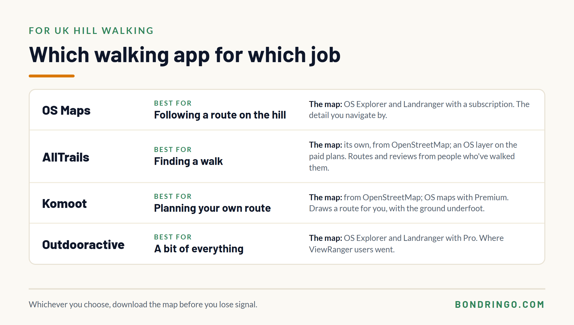
So here’s the short answer. For hill walking in the UK, the best walking app is whichever one puts the Ordnance Survey map on your phone, downloaded so it works without signal. For most people that’s OS Maps, because it’s built around that map. AllTrails is the best for finding a walk someone else has done. Komoot is the best for planning a route of your own. Outdooractive does a bit of everything, and is one of the cheapest ways to get the OS maps for the whole country.
None of them is a navigator, though. Every one of them will happily lead you somewhere you shouldn’t be, and we’ll come to that.
In this guide we’ll go through what a walking app actually needs to do on a hill, what each of the big four is good and bad at, what they cost, and how to set one up so it doesn’t let you down when it matters.
Which is the best walking app in the UK?
It depends what you want it for. Whether you call it a walking app or a hiking app, the choice comes down to the same few things. Prices below were checked on each app’s own website in November 2026, and they do change.
| App | Best for | The map | Offline maps | Cost |
|---|---|---|---|---|
| OS Maps | Following a route on the hill | OS Standard free; OS Explorer and Landranger with Premium | Premium, or free for any sheet whose paper map you own | Free, or £7.49 a month or £35.99 a year |
| AllTrails | Finding a walk | Its own, built from OpenStreetMap; an OS layer with Plus or Peak | Plus or Peak | Free, or £35.99 a year (Plus) or £79.99 a year (Peak) |
| Komoot | Planning your own route | Built from OpenStreetMap; OS maps with Premium | Any region you’ve unlocked, and your first is free | Free to plan; map regions bought once; Premium around £60 a year |
| Outdooractive | A bit of everything | OS Explorer and Landranger with Pro | Pro or Pro+ | Free, or about £25 a year (Pro) or £50 (Pro+) |
| Organic Maps | A free app that works offline | Built from OpenStreetMap, with contour lines | Free, for any region you download | Free |
If you’re new to the hills and only want one, get OS Maps. It’s the simplest way to get the OS map on your phone, it has a grid reference finder built in, and if you already own the paper map for your area, the digital copy comes free with it.
If price matters most, Outdooractive Pro gives you the same OS Explorer and Landranger maps for the whole of Great Britain for less. So does Footpath, a simpler app where you draw your route with a finger. Its Elite plan, £22 a year, adds offline maps and OS mapping.
If you mostly walk lowland routes and want ideas for where to go, AllTrails will give you more walks than you’ll ever do. And if you like drawing your own routes and want to know what’s underfoot, try Komoot.
If you don’t want to pay anything at all, get Organic Maps. It’s free, it works offline, and it makes a very good second app.
What should a walking app actually do on a hill?
Before we compare apps, it’s worth knowing what you’re judging them on. A walking app has four jobs, and only one of them is about routes.
- Show you a map you can navigate by. On a hill that means contour lines detailed enough to read the shape of the ground, plus the walls, fences and streams you’ll use as handrails. A map that shows a path on a green background is fine until the path disappears.
- Show you where you are. Every app does this with your phone’s GPS, and GPS works with no mobile signal at all. It listens to satellites, not phone masts.
- Keep working with no signal. Your position still shows without signal, but the map underneath it only does if you downloaded it before you set off. In most of these apps, offline maps are part of what you pay for.
- Give you a grid reference. If you ever need Mountain Rescue, the first thing they’ll need is where you are. A six-figure grid reference is the clearest way to tell them.
Keep those four in mind. The route library, the badges and the reviews are nice to have. The map and the offline download are what matter in cloud.
OS Maps: the one with the proper map
OS Maps is Ordnance Survey’s own app, and its big advantage is the map. With a Premium subscription you get the OS Explorer at 1:25,000 and the Landranger at 1:50,000 for the whole of Great Britain, the same maps as the orange and pink paper sheets. If you’re not sure which of those two you’d want, we cover it in which OS map do I need.
Premium costs £7.49 a month or £35.99 a year, and it also unlocks offline downloads and 3D views.
There’s a cheaper way in if you walk in one or two areas. Every OS Explorer and Landranger paper map comes with a code for a digital copy. Redeem it and you can download that sheet’s area to the OS Maps app for offline use, with no subscription. It’s stored against your account, so it comes with you when you change phone.
The app also has Locate Me, which gives you your grid reference from the phone’s GPS with no signal needed. It’s the feature that replaced the old OS Locate app, and we explain where to find it in OS Locate has gone: what to use instead. Ordnance Survey don’t say in writing whether it needs Premium. In my experience it works on the free version, but check it on your own phone before you rely on it.
Never Feel Lost Again: The Free UK Navigation & Safety Pack
Stop relying solely on a fragile phone battery. Download the exact tools a professional outdoor instructor uses to stay safe in the British hills.

Enter your email below to get instant access to:
- NEW: The Hike Planning & Safety Checklist: A comprehensive pre-walk checklist to ensure you never leave a critical item behind or rely purely on a smartphone.
- The Emergency Protocol Guide: A highly structured, zero panic system detailing exactly what to do if lost on Dartmoor/Scottish hills, including when and how to call Mountain Rescue.
- The OS Map & Navigation Cheat Sheet: A quick reference guide to decoding complex map symbols and plotting grid references when your mind goes blank.
- The Route Card Template: The exact, logic-driven framework I use to plan foolproof expeditions and identify safe escape routes before leaving the house.
- The Timing Crib Card: Never misjudge daylight again. Master the mathematics of measuring pacing distance and timings for steep ground.
Is the OS Maps app free?
Yes and no. The app is free to download, and the free version gives you OS’s Standard map, plus planning, recording and following routes.
What you don’t get without Premium is the OS Explorer and Landranger mapping, or the ability to download maps for offline use. Those are the two things that matter most on a hill. The way round it is the code inside a paper OS map, which unlocks that one sheet in the app with no subscription.
AllTrails: the best for finding a walk
AllTrails is a huge library of routes, each with photos, reviews and a difficulty rating from people who’ve walked it. For finding something new near home it’s very good, and the recent reviews often tell you things a map can’t, like a path that’s flooded or a stile that’s gone.
The free version is fine for browsing walks and reading reviews. To download maps for offline use you need AllTrails Plus (£35.99 a year) or Peak (£79.99 a year), and both come with a seven-day free trial. The standard map is AllTrails’ own, built from OpenStreetMap data, and the paid plans add an Ordnance Survey layer for Great Britain.
The catch is where the routes come from. Some trails are checked by AllTrails, but many more are uploaded by members, and a route is only as good as the person who recorded it. The difficulty rating and the reviews are useful, but they describe other people, on other days, in other weather.
OS Maps vs AllTrails: which is better?
They’re better at different jobs. AllTrails is better for finding a walk. OS Maps is better for following it, because on a hill the detail of the map is what keeps you on the route when the path fades.
Plenty of walkers use both. Find the walk on AllTrails, check it against the OS map at home, and follow it on the OS map on the day. That check at home is where you spot the steep ground, the river crossing and the stretch with no obvious way off.
Komoot: the best for planning your own route
Komoot is a route planner first. You tell it where you want to start and finish and it draws a route along paths and tracks, with an elevation profile and a breakdown of what’s underfoot. It’s popular with cyclists for the same reason.
Planning is free. To navigate a route or record one, you need that map region unlocked, and new users still get their first region free, offline maps included. After that you buy more regions, or the World Pack for everywhere (£29.99), as one-off payments. Komoot Premium, a subscription of around £60 a year, adds local topographic maps, which in Britain means OS mapping, plus 3D and weather. Komoot changed owners in 2025 and its prices have risen since, so check before you pay.
The standard map is built from OpenStreetMap, which is mapped by volunteers rather than surveyed. In the UK it’s very good in some areas and thin in others.
The catch is that clever routing. Komoot draws the route the data allows. It can’t see that a path on the map is a faint line across a boggy plateau, or that the shortcut it found drops down ground you’d never choose in cloud. Treat its route as a first draft, and check it against the contours before you trust it.
Outdooractive, and what happened to ViewRanger
Outdooractive does route planning, navigation and a large library of routes from official partners and its own community. The free Basic version plans and navigates, but has no offline maps.
Pro, about £25 a year, adds offline maps and the OS Explorer and Landranger mapping for Great Britain. Pro+, about £50, adds Harvey maps too. You’re charged in euros, so the pound figure moves a little.
If you used ViewRanger, this is where it went. ViewRanger was merged into Outdooractive in 2021, and the old app and website were switched off in early 2022. Walkers who had OS maps in ViewRanger were given them in Outdooractive.
Organic Maps: the best free walking app
If you want a free app that works without signal, Organic Maps is a good one. It’s free, with no adverts, no tracking and no account to set up. Download the region you’re walking in and it works with no signal at all.
It’s better for walkers than you’d expect from a free app. There’s an outdoors map style that picks out paths, huts, shelters and water, it shows contour lines, and it records your track as you go. You can also load a route someone has sent you as a GPX file.
The catch is the map. Like the standard maps in Komoot and AllTrails, it’s built from OpenStreetMap, not the OS map. That’s very good in some areas and thin in others, so compare it with the OS map for the ground you walk before you rely on it.
Where it really earns its place is as a second app. If your main app crashes, or you haven’t paid for its offline maps, Organic Maps on the same phone with your area downloaded costs nothing and takes a few minutes to set up.
Can you see OS maps for free?
Partly. The free version of OS Maps, on the app and the website, shows OS’s Standard map, not the Explorer or Landranger.
Bing Maps used to show OS mapping for free, but that layer disappeared in the autumn of 2025. In November 2026 the free site still showing OS 1:25,000 and 1:50,000 mapping is Streetmap, which is fine for planning at home but no help on the hill without signal.
For offline OS mapping on your phone without a subscription, the code in the paper map is still the best deal going. You get the sheet in your rucksack and a copy on your phone, for the price of the map.
What does no walking app do?
Here’s the bit the app reviews leave out.
In a Mountaineering Scotland survey of about 4,000 hill users, 87% had used an electronic device to navigate, and 40% of those had had their device stop working in some way. That’s not a reason to leave the phone at home. It’s a reason to carry the paper map as well, and to know how to use it.
Ordnance Survey, which does sell an app of its own, has put part of the rise in younger walkers needing rescue down to “mobile phone apps that lack the accurate detail required to navigate safely in remote areas”. That’s OS’s reading of the figures rather than a statistic, but the point stands. The app is only as good as the map inside it, and the person holding it.
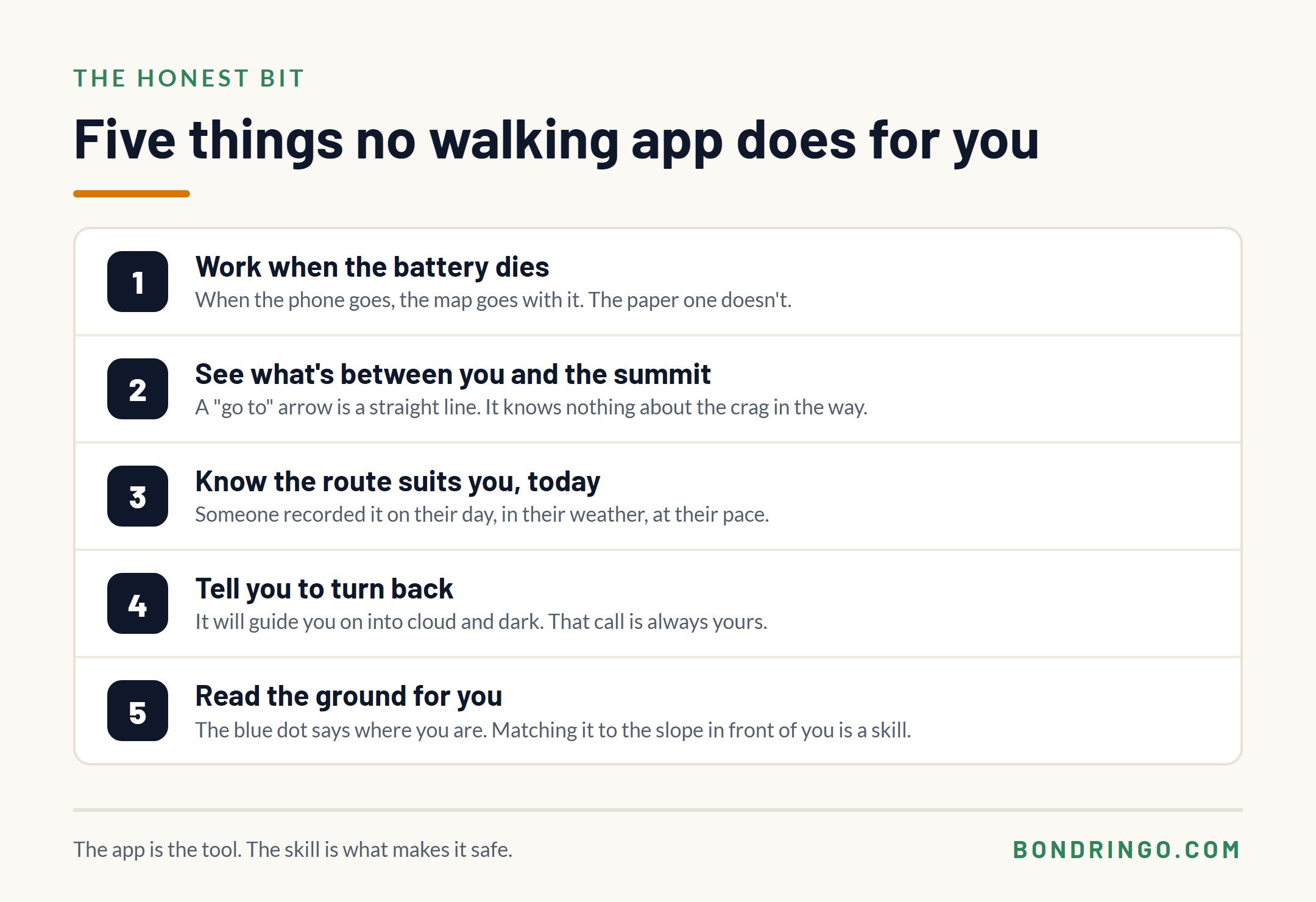
Whichever app you choose, there are five things it won’t do for you.
- It won’t work when the battery dies. When the phone goes, the map goes with it.
- It won’t see what’s between you and the summit. A “go to” arrow is a straight line on a flat screen. We go into why that matters in is your phone enough to navigate.
- It won’t know whether a route suits you today. Someone recorded it on their day, in their weather, at their pace.
- It won’t tell you to turn back. It will guide you on into cloud and dark without a flicker. That decision is always yours.
- It won’t read the ground for you. The blue dot tells you where you are. Matching that to the slope in front of you is a skill, and it’s the one that gets you home.
If you want the longer version of that argument, it’s in paper maps vs GPS.
How to set up a walking app before your first hill walk
Whichever app you pick, ten minutes at home is what turns it from a gadget into something you can rely on. Here’s the routine.
- Pick one app and learn it on the sofa. A hillside in the rain is no place to find out where the menus are.
- Download the map for the whole area, not just the route. Include the ground either side and your way off. Then put the phone in aeroplane mode, close the app completely, open it again and check the map still draws. If it doesn’t, it isn’t downloaded.
- Find your grid reference before you need it. Open Locate Me in OS Maps, or try our free grid reference finder in your phone’s browser, so you know exactly where to look.
- Look after the battery. Aeroplane mode at the start of the walk, not when you’re down to 20%, and a power bank with a cable you’ve tested. The full routine is in how to make your phone battery last all day.
- Register for emergency texts. Text the word “register” to 999 and follow the replies. It takes a couple of minutes because you have to wait for their messages, which is exactly why you do it at home. More in register to text 999.
- Pack the paper map and a compass anyway. The app is your quick check. The map is your backup.
Frequently Asked Questions
What is the best walking app in the UK?
For hill walking, the best app is one that gives you the Ordnance Survey map offline. For most people that’s OS Maps, which carries the OS Explorer and Landranger maps with Premium. AllTrails is better for finding new walks and Komoot for planning your own route. Whichever you use, download the map before you go.
Is the OS Maps app free?
The app is free to download, and the free version shows OS’s Standard map and lets you plan, record and follow routes. The OS Explorer and Landranger maps and offline downloads need OS Maps Premium, £7.49 a month or £35.99 a year in November 2026. Every OS Explorer and Landranger paper map also includes a code that unlocks that sheet in the app, offline, with no subscription.
What is the best free walking app in the UK?
Organic Maps is the best free app that works offline. It has no adverts and no account, and gives you offline maps with contour lines and an outdoors style, though the map is built from OpenStreetMap rather than OS. No free app gives you OS Explorer mapping offline for the whole country. The closest is buying the paper OS map for your area and redeeming its code in OS Maps, which puts that sheet on your phone with no subscription.
Is AllTrails or OS Maps better for UK walking?
They do different jobs. AllTrails is better for finding a walk, with reviews and photos from people who’ve done it. OS Maps is better for following one on the hill, because the OS map shows the detail you navigate by. Many walkers find a route on AllTrails and follow it on OS Maps.
What happened to ViewRanger?
ViewRanger was merged into Outdooractive in 2021, and the ViewRanger app and website were switched off in early 2022. Outdooractive is its successor. Walkers who had OS maps in ViewRanger were given OS 1:25,000 and 1:50,000 maps in Outdooractive.
Do walking apps work without signal?
Your position does, because GPS works with no mobile signal at all. The map only does if you downloaded it before you lost signal. Download the whole area at home, then test it with the phone in aeroplane mode.
Pick one, set it up, then learn the map
Choose the app that fits how you walk, set it up at home, and test it before the hill tests it for you. This week, download the map for your next walk, put the phone in aeroplane mode on the kitchen table, and see whether the map still draws.
If you want help setting your phone up properly, our free Digital Safety Net course does exactly that, in 16 short lessons: offline maps, battery, your grid reference, Text 999 and what to do when the phone gives up. Ask any questions in the comments below.


